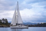

. . . and no fish eggs in Fish Egg Inlet that we could discover. We arrived in this very remote and secluded bay on Sunday afternoon after motoring north for about three hours in Fitz Hugh Sound, under steely skies, from the spectacularly beautiful and tranquil Fury Cove. The wooded inlet’s wandering waterways contain many rocks, islets, and islands, and include a number of smaller inlets, bays, coves, lagoons, and nooks in which one might drop hook. We chose Oyster Bay at the northern end of a winding inlet near the eastern terminus of Fish Egg Inlet, and anchored between a small island at one end of the bay and some happily chattering rapids at the other.
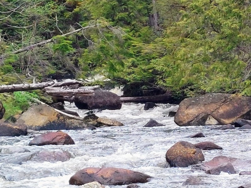
Walt took Coracle, our dinghy, out and around the bay, visiting the rapids and the island, and found that the Honda outboard motor performed well apart from its gas cap needing to be loosened every now and then because air seems not to be venting properly, for some reason (always a new puzzle to solve!). He took me out in the dinghy to shoot some photos of the rapids, from whence was issuing some sort of white, foamy substance that was not soap—I dipped my hand into one of the swirls of bubbles and sniffed, and there was no odor or detergent-like slickness, and the rain, that began in the evening, seemed to have no effect on it. The breeze and the water’s surface current gradually dispersed the foam, in lacy whorls and tiny blobules and slightly yellowish clumps, throughout the bay, and soon Braesail was surrounded by it as if she had been captured by an invading flotilla of little white alien watercraft–rather unnerving! By this morning (Monday, May 23), both the rain and the foam were gone, though the heavy overcast remained throughout the day! Have you any ideas about this mysterious substance?

Once back on board Braesail, we took an inventory of our docking lines to determine which ones were of which lengths and which needed trimming and/or mending (Walt completed those projects this afternoon). We also devoted a good deal of time on Sunday evening and throughout the day today to reading guide books and narratives and anecdotes and recommendations, and to consulting charts, maps, and wind predictions to help us plan the next phase of our journey. Sometime in the next 10 days or so, we’d like to make the 85-mile, 12-hour crossing of the infamous, and sometimes dangerous, Hecate Strait that separates the islands just off the B.C. coast from the incomparable archipelago of Haida Gwaii (formerly called the Queen Charlotte Islands), and we will be watching the weather to identify safe conditions under which to undertake the journey. For tomorrow, though, we plan to travel to Pruth Bay on Calvert Island and spend Tuesday night and Wednesday there.
