Today, a very “mixed-weather” day, we were notified by UPS that our new satellite phone is on its way from England and should arrive in Port McNeill by the end of the day on Thursday, meaning that we can leave here (Alert Bay) sometime on Thursday, fill the diesel tank, buy supplies, and be on our way north once again on Friday. The satellite phone allows us to send and receive mail and make calls in remote areas, but, most importantly, it provides us with a huge amount of weather- and sea-related data and turns Walt’s tablet computer into a highly valuable weather station. We hope that this unit will be ready to GO! this time!
Winds were erratic today, but Walt found an opportunity to motor away from the dock and out into the bay to empty our holding tank while winds were calm (the pump-out facility here is not working, and sewage discharge into the open sea is legal in Canadian waters). I remained on the dock to receive the mooring lines upon his return and to help tie up Braesail once more–a storm with high winds is predicted for Tuesday and Wednesday, and we are happy to be docked securely behind the breakwater!
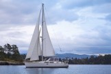
While Walt was “out at sea”, I noticed that a sizeable drift log was floating near “our space” between two boats at the dock, so I waited for the wind to give it a push in my direction, knelt down, leaned over the water, grabbed one end when it came within reach, and managed to maneuver it onto the dock–it was quite heavy! Braesail’s return went smoothly, and we are now safe and snug in Alert Bay Harbour once more.

Not long after lunch, the Senior Warden of the local Anglican church stopped by to ask for Walt’s help in planning for future lay-person-led worship. We’d met Jamie (a singer and leader of the community choir in Alert Bay) at coffee hour after the morning Eucharist at Christ Church and had enjoyed a good conversation with him and his wife. Walt and Jamie plan to meet tomorrow to talk–I’m so pleased that Walt is being consulted as a liturgist, something that happens VERY rarely!
During the late afternoon and evening, I worked on the planning of our trip from Port McNeill to Fury Cove to the north. We will be traveling around the notorious Cape Caution, another area that, like tidal rapids, can be very dangerous if winds are blowing against the direction in which currents are flowing and waves are large and closely-spaced as a result. I read articles about passing Cape Caution safely that provided checklists of things to be aware of before making the journey, looked at an automatically-generated route on a chart plotter, read descriptions of safe anchorages, consulted tables showing currents (times, strength, and direction) and tides (times and heights for flood, slack, and ebb) for the appropriate days and places, took note of the moon’s upcoming phases (which influence tide heights), looked at predictions for strength and directions of winds and for sea state (wave heights and periodicity), brought up maps of approaching weather systems in the northern Pacific, and saw recent reports from area buoys and lighthouses, all with Walt’s guidance. We decided that a 7-am launch from a marina in Port McNeill on Friday morning, with possible stops at two anchorages along the way to Cape Caution, should lead to the safest rounding of the cape. We will modify our plans as necessary as conditions change over the next several days.
