Wednesday, June 5, 2024
BANG!! Braesail’s keel smacked into some object lying on the bottom of Forward Harbour as we were leaving, having approached the shore at the far end and watched the numbers on the depth sounder descend: 12 feet, 11, 10, 9, 8, 7—time to turn around and get out! The boat’s keel reaches about 6.5 feet below the water’s surface, and there were no charted rocks on the map, but we hit a submerged something that sounded metallic and the sudden hard jerk knocked things around on the galley counter and elsewhere below decks. I cried out in fright, but Walt reassured me that no real damage had been done, and I believed him, I think! Yes, we have hit underwater objects before, but the noise and the sudden jolt always terrify me.
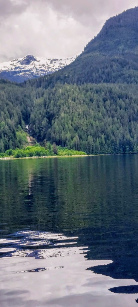
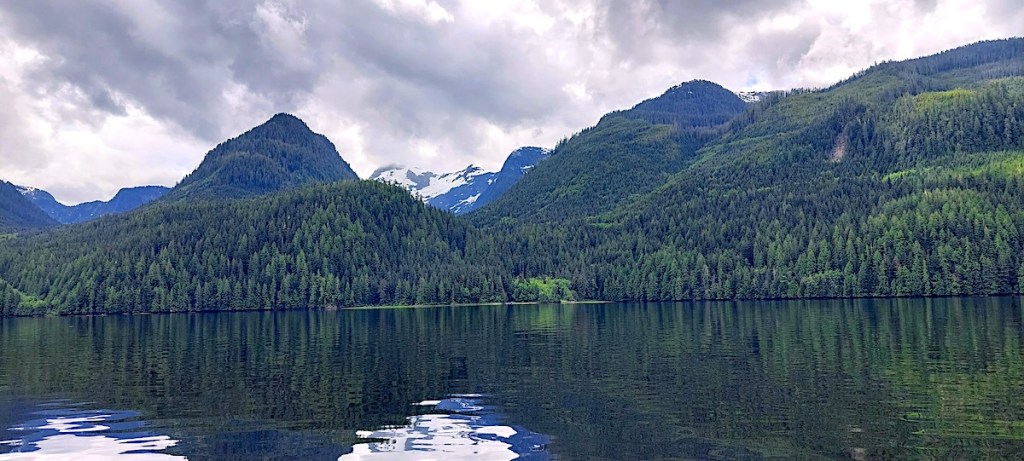
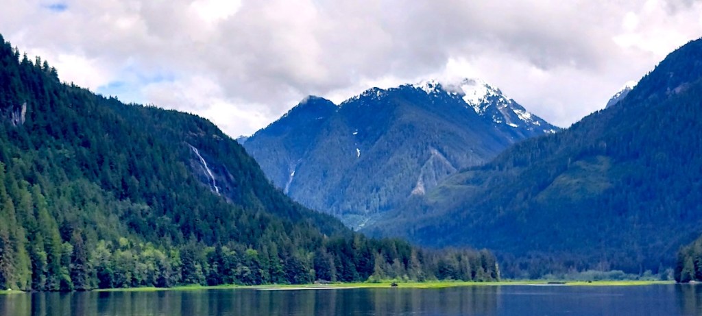
An otherwise excellent day had begun at about 8 am after we’d had a supremely quiet night at anchor. We motored out of the Cordero Islands Anchorage under cloudy skies and transited the Greene Point Rapids with no difficulty as the water swirled and rippled here and there at slack tide but did not shove the boat about at all. We turned from Chancellor Channel into thirty-mile-long Loughborough (evidently pronounced “loch-brough”) Inlet and made our way in still air and over smooth water between lofty forested hills whose granite feet were swaddled in thick tapestries of green-gold and copper-colored mosses. Snow-splotched peaks peeked out from their cottony cloud-quilts, and an occasional waterfall somersaulted down the cliffs into the sea. This inlet was indeed beautiful, but not as spectacular as Toba Inlet and some of the other channels through which we have traveled, and at one point we considered turning back and going further along Chancellor Channel. I thought I’d like to go on to the head of the inlet, however, and we were glad that we did, because the scenery became ever more breathtaking as we proceeded.
Near the head of the inlet, the water at last became too shallow to accommodate Braesail’s keel,

and so we turned back down the inlet and again motored because of lack of wind. On our way up the inlet, we’d seen a prawning boat at work, and now saw that it had stopped and its crew was processing their catch. We pulled alongside and asked if there were any prawns for sale, and when they answered in the affirmative, Walt maneuvered the boat close enough for a crewman to hand us a 2-pound box of fresh prawns in exchange for two Canadian 20-dollar bills. What great meals we’d have!
On we motored through the Whirlpool Rapids, since the tide was running at slack and there was scarcely a ripple to be seen across the channel’s waters, and we were soon entering Forward Harbour. As we progressed, I enjoyed observing the stunning colors of the water through we passed: it was a bright emerald green on the sunny side of the boat, and a rich jade green on the shady side.
We’d stayed in Douglas Bay near the harbor’s entrance during earlier excursions, and so I wanted to see what the east end of the harbor was like. The wooded shores featured some lovely, grass-lined beaches, but pieces of timber and rusty equipment had been abandoned along the shores near the site of an old fishing lodge, a sad and uncomfortable sight. For quite some distance, the water remained deep as we approached the harbor’s head, and as soon as the depth sounder indicated increasingly shallow waters, we turned back—the sounder read 11 ft., which should have been a safe depth, but . . . AAARGH!! Back from Forward Harbour we went to drop the anchor safely in Douglas Bay!
A wonderful dinner of steamed fresh prawns perched atop a hill of rice cooked in prawn liquor helped to dim my memory of the collision, and a substantial rain shower left the air, the shoreline forest, and Braesail well rinsed. As I fall asleep, I will try to focus on the beautiful sights in Loughborough Inlet and let “other thoughts” wash away.

I just checked the should-be-current CHS charts on Aqua Map, and looked up that area on CHS’s Notices to Mariners, and saw nothing on the charts other than a rock at 50d28’37.87”N 125d45’43.46”W, which I seriously doubt you would have encountered (and if you did, you can be suitably embarrassed, but…)
You might be the first one to, er, run into this uncharted wreck, which isn’t surprising. While that area is reasonably well charted as far as its basic bathymetry, CHS doesn’t get up into little channels like that very often to update things. Combine this with Canada’s notoriously loose vessel registration/title policies, and stuff happens on the bottom that official documentation would never report on.
So if want to do your civic duty to the boating community, I suggest you file a MAREP on this to report it in to CHS. Make a difference! https://www.charts.gc.ca/help-aide/marep/index-eng.asp
LikeLike
To follow on the last comment: the (paper/PoD) chart that covers where you are is #3544 (you can report that to them in your MAREP, since they have a field for it), and the last NOTMAR for that chart/area was issued in 2018. (Bingo!)
LikeLike