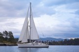
Braesail untied and motored away from her companion vessel, Third Watch, on Friday, August 12, at around 9 am with the beautiful Warm Springs Bay waterfall swooooshing behind her. We motored under somber skies for about five hours while a parade of majestic cerulean mountain peaks marched beside us, and docked beside the Tlingit village of Kake (which translates in Tlingit to “mouth of the dawn” or “opening of daylight”), home to the world’s third largest totem pole and about 500 residents, in the early afternoon.


We spent some time walking down the main street of the town to the Presbyterian Church and back, and spoke with the woman behind the counter in the liquor store about life and activities there after seeing many vacant and dilapidated buildings. She mentioned fishing and hunting, and confirmed some of what we’d read about the renovation of an old seafood cannery to eventually house small shops and a museum to appeal to tourists, and the building of a new dock at the other end of the town where the grocery store is. As we’d walked, we’d seen a relatively new apartment building and a high school on a hill, which I found encouraging.
Before we docked in Kake, I’d seen something in the water that looked like a tiny brown canoe, and when the something began paddling, I knew it wasn’t a piece of driftwood but must be a sea otter. At the dock, we saw some larger creature(s) splashing–probably a seal or two–and then later on, as we were heading for Stedman Cove (our destination for the day), Walt was napping, I was at the helm, and I saw a number of sea otters, swimming and diving as Braesail motored by. Two of them kept their furry heads up and simply watched the boat–VERY cute indeed!
We anchored as the only boat in wide and quiet Stedman Cove, located at the beginning of a 20-mile very narrow, shallow, twisty waterway called Rocky Pass, which is filled with islets, islands, kelp patches, and so many rocks that the red dots on the chart that mark their locations make the chart screen look as if it is suffering from a bad case of measles! We spent the evening going over the chart and making a list of all 40 navigation aids (markers, buoys, lights, etc.) and their locations and numbers, together with any special notes, as we did in preparation for navigating Wrangell Narrows, and Walt then entered his course on the chart plotter in the cockpit. It’s our 100th course plot of this trip, our engine has now been used for 3000 hours since its installation on the boat 21 years ago, and we’ve been on this journey for 18 weeks now–so this is a “suspicious occasion,” as my father used to say!
Now it’s time for bed–we have a big day tomorrow, and I’m glad that rain is not in the forecast!
