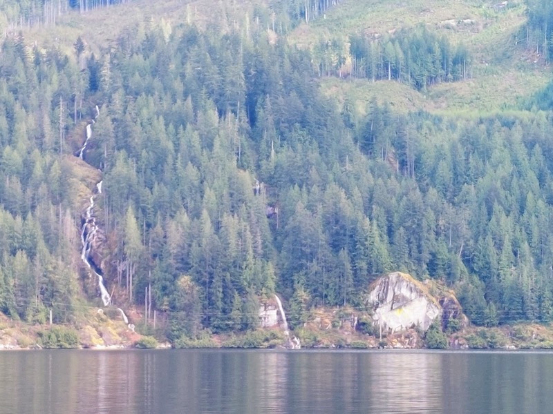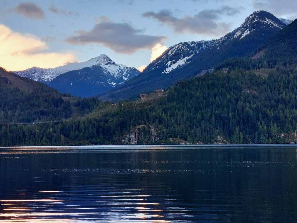
What a breath-taking place! We arrived here in Misery Bay, formerly an active center for log-transport, in mid-afternoon on Monday after motoring, under overcast skies through sometimes-strong headwinds and sporadic showers, down Sechelt Inlet and up Salmon Inlet to this gorgeous bay. We are surrounded by dark-green velvet hills, snow-swept peaks, silver-white waterfalls, rocky, thickly wooded shores, and a few stands of light-leafed deciduous trees in this sheltered spot, remote and tranquil, where the soundscape centers on the breathing of inflow and outflow winds and the “rush-sh-sh-sh” of a small waterfall or rapids hidden among some shore-side cedars. Now and then, the raucous “hronking” cry of a Canada goose, the warble of a loon, or the call of some other bird captures one’s ear, but there is, over all, a great calm here that has caused us to decide to stay until Wednesday morning. There is NO connectivity here; VHF and SSB radio provide our only contact with the “outside world.” So, no phone, no internet, no email–and posting of blog updates will have to wait (you deserve a break!).

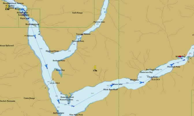
After a quiet Sunday night, we left Backeddy Marina just after 11 am on Monday in order to pass through the renowned Sechelt Rapids, also known as the “Skookumchuck”–“skookum” meaning “powerful” and “chuck” meaning “water”– Rapids, at slack tide when the waters are comparatively untroubled. Currents race through the channel here at speeds as high as 17 kts. under certain conditions, producing large, strong standing waves and dangerous whirlpools, and if boats attempt to transit under such circumstances, disasters can occur and lives can be lost. Expert kayak surfers come to these amazing tidal rapids to test their skills, and you can watch the action here: https://www.youtube.com/watch?v=aRY7wTQYwXQ
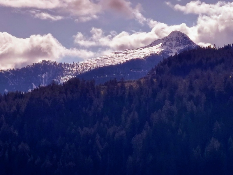
Our passage through the narrows and rapids was uneventful (as we’d planned!), and our journey to cloud-shrouded Misery Bay (I think of it as “Blissful Bay”–was it named after some loggers’ dreadful experiences?), under the grand gaze of the mountain peaks
and past small islands and hissing, splashing Misery Falls,


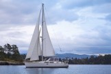
was very lovely despite the gloomy skies (it was bright and sunny when we motored down the inlet on the 27th, as you can see). We unfurled Braesail’s foresail (the jib) at one point and attached it to the “whisker pole” that holds it away from the mast, but no sooner was the sail rigged than the wind died away, and we had to return to motoring.
This showery afternoon is proving to be a good time to read BOOKS and saved laptop files, to play backgammon, to listen to music from our huge audio file collection, to nap, to write blog posts to publish later, and, above all, to offer praise for God’s unbounded and indescribable creativity and to pray for the wisdom to conserve God’s handiwork.