Wednesday, May 29, 2024
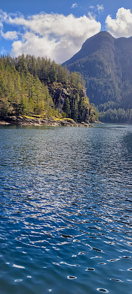
Most of Tuesday was absolutely wonderful: We left Laura Cove at about 10 am under sunny skies, and motored for a shorrt while until a tailwind began to chase us up Toba Inlet as it wends its watery way into the snow-crested B.C. Coast Mountains. We raised the genoa (the large headsail at the bow of the boat) and enjoyed smooth and comfortable sailing for two hours as we admired the shoreline scenery: mammoth granite “massifs,” cloud-piercing peaks, green-velvet glacier-carved “hanging” valleys, and wondrous waterfalls of all lengths and configurations, from slender, twisting threads to foamy, splashing cataracts, that somehow found paths from glittering snowfields, through thick forests, into the sea.


We reached the marshy head of the 30-mile-long inlet, where it is fed by rivers and streams, at about 3 pm and noted that the increasingly vigorous inflow winds were continuing to rise, and there was no safe place to anchor near a shore-side logging operation or near the wetlands, as we knew would probably be the case. So we decided to turn around and motor back down the inlet into the wind and enjoy the scenery from a different vantage point and at a different time of day—I think that it looked even more spectacular during our late-afternoon journey with clouds having lifted from the mountain tops, sun sparkling on the snowfields and on the gray-green water of the inlet, and occasional mists of rain enfolding the mountains.
While we were motoring, however, the chart-plotter on the instrument panel behind the helm in the cockpit suddenly went dark, and we could no longer see maps, our route over the water and Braesail’s position on it, other boats in the area, depth contours, and other information that we rely on in order to travel safely. This had happened a few times in previous years, but Walt could always “re-boot” the computer and the plotter would recover and function again. This time, it died and stayed dead, indicating that a fatal error had occurred and there was nothing to be done but order a new plotter (about $1,000). At about the same time, our depth sounder began to provide questionable readings, and as we approached our chosen anchorage in Walsh Cove, a rain squall buffeted us with rain and wind, and I prepared for a good wetting as I stood out on the bow helping with the anchoring process.
The storm blew through quickly, and I got damp (but not doused!) and felt cold, but we anchored successfully as the only boat in the large, lovely cove. As a frustrated Skipper tried to figure out how to confirm our depths and need for anchor chain, the sun painted a misty rainbow on a forested hillside nearby, and I tried to be hopeful. Walt attached a heavy plumb-bob to a very long, thin line and dropped the weight overboard, then measured the line; our depth sounder read 70 ft., and that was the length of the line from the bottom of the cove to the water’s surface—good—perhaps our depth sounder was sounder than we thought! He let down more anchor chain (a “long and winding rode!”) and then I warmed some soup while he called our son Martin and they talked about replacing the chart-plotter, laptop, etc. and how to obtain such things in a very remote area in a reasonable amount of time and without excruciatingly large travel expenses.
The cove was completely quiet as we went to bed, though, when I was on Braesail’s deck, I could hear the gurgling and splashing of a stream or small waterfall hidden somewhere in the shore-side brush. The day had brought great beauty, excellent sailing, and now some problems to solve, but we were safe and well and thankful!